BRIF – Forest Fire Risk Bulletin National Agency for Water and Forests

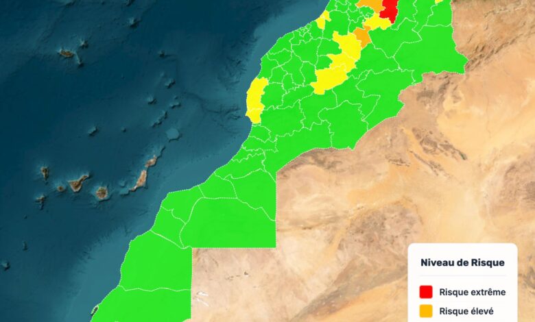
To proactively address the issue of wildfires in our country, the ANEF produces maps through its scientific prediction models that accurately identify high-risk areas across the national territory.
For the period from August 17, 2025, to August 20, 2025, and following an analysis of data concerning:
– The types of forests and their levels of combustibility and flammability
– The topoclimatic parameters
The following risks have been identified:
• Extreme risk: in the provinces of Chefchaouen, Fahs-Anjra, Tanger-Assilah, M’Diq-Fnideq, Taza.
• High risk: in the provinces of Al Hoceima, Larache, Ouezzane, Tétouan, Ifrane, Taounate.
• Moderate risk: in the provinces of Berkane, Driouch, Nador, Oujda-Angad, Sefrou, Rabat, Salé, Skhirate-Témara, Azilal, Béni Mellal, Khénifra, Essaouira, Agadir-Ida-Ou-Tanane.
Residents living near forests, as well as all summer visitors and citizens, including those working in forested areas, are urged to exercise caution and take the necessary precautions to prevent the outbreak of wildfires.
Additionally, they should promptly alert local authorities if they observe smoke or suspicious behaviors.


