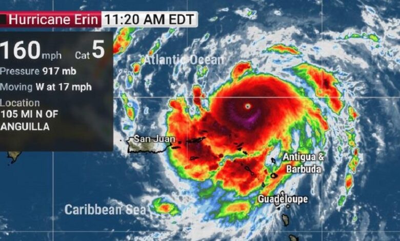
Erin Becomes a Category 5 Hurricane, Threatening the Caribbean

Hurricane Erin was classified as a Category 5 storm on Saturday, the highest level on the Saffir-Simpson scale, according to the National Hurricane Center in the United States. It now poses a serious threat to several Caribbean islands due to heavy rainfall and flooding risks.
With sustained winds reaching 160 mph (260 km/h), Erin continues its westward path over the Atlantic Ocean. Although it is not expected to make direct landfall in the United States, it will still generate powerful waves along the East Coast.
According to forecasts from the Hurricane Center, “the size of Erin is expected to at least double, or even triple by the middle of next week,” which could worsen maritime conditions in the western Atlantic.
Heavy rainfall is anticipated in the coming days across the northern Leeward Islands, the Virgin Islands, and Puerto Rico.
Erin became a hurricane on August 15, marking the first of the Atlantic hurricane season, which began on June 1 and runs until the end of November. The most active period typically occurs between mid-August and mid-October.


